
Most outstanding benefit to the residents of Fremantle 2022
How can we use Open Data to most benefit residents of Fremantle?
Go to Challenge | 4 teams have entered this challenge.
Team Name:
Open Source Fremantle
Team Members:
Open Source Fremantle
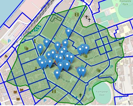
A web-based system for exploring rich open datasets about Fremantle at the street scale, combining history and amenity resources with themes of walkability and public transport. Offering opportunities to learn about your local area and contribute your own observations, photos and local knowledge. For the purpose of finding out about your neighbourhood and having a single place from which to access many resources.
Using ABS, data.wa and OpenStreetMap data as the base datasets for the web map. Linking to inHerit, Wikimedia Commons, Wikipedia, Wikidata, iNaturalist (and City of Fremantle datasets if possible). Also linking to a small local streets project.
Residents will be offered links to Wikimedia Commons for uploading photos of their area, links to iNaturalist for uploading flora and fauna observations, links to a local Freo streets project for adding their own (textual) information about their neighbourhood.
All the datasets and databases presented on this web platform are hosted with open source projects (or government agencies) alongside any privately managed but openly available projects. This means that there is no data hosting overhead for whoever is managing this site. This reduces the maintenance requirements and means it is likely to be a successful long-term project that Fremantle residents to come to appreciate, enjoy and rely on for local information and resources!
Description of Use If we'd had time we wanted to add this data as an overlay on our map. To show people which public transport options are available - alongside interesting places/photos/articles, walking distance data and urban forest data.
Description of Use If we'd had time we wanted to display this data for each selected meshblock on our map (and surrounding few). Particularly to be read in conjunction with walking distance shapes.
Description of Use We would have loved to use some of the data layers shown on the City of Fremantle web maps, but unfortunately they are not open and we could not access them. We would have used: parks, dog walking areas, landmarks datasets and more.
Description of Use We're linking to inHerit entries via Wikidata.
Description of Use Just linking to this project. In the future it'd be great to display iNaturalist observation locations on our map.
Description of Use Using this as a source of photographs for the local area.
Description of Use Articles about local places and people.
Description of Use Used as a connector for OSM street data, Wikipedia, inHerit and Wikipedia articles.
Description of Use Downloaded some demographic data for 2016 Fremantle meshblocks as csv. Used 2016 data because 2021 not yet available in TableBuilder. Processed the data with ABS ASGS data and converted to geojson, and Lua dictionary formats. Downloaded population, household types, ancestry and language measures. Future versions of the web app will definitely use the ABS API instead of this process.
Description of Use Downloaded as shp then converted to geojson and other formats. But future versions of this application will definitely make use of the ABS API instead.
Description of Use Using this data to get streets adjacent to meshblocks of interest, to extract points of interest and amenities. If we'd had time we also wanted to calculate 15 minute walkable polygons along the road network. To display as a layer beneath all the POI datasets on the map.
Go to Challenge | 4 teams have entered this challenge.